#favelas #LiDAR #visual AI
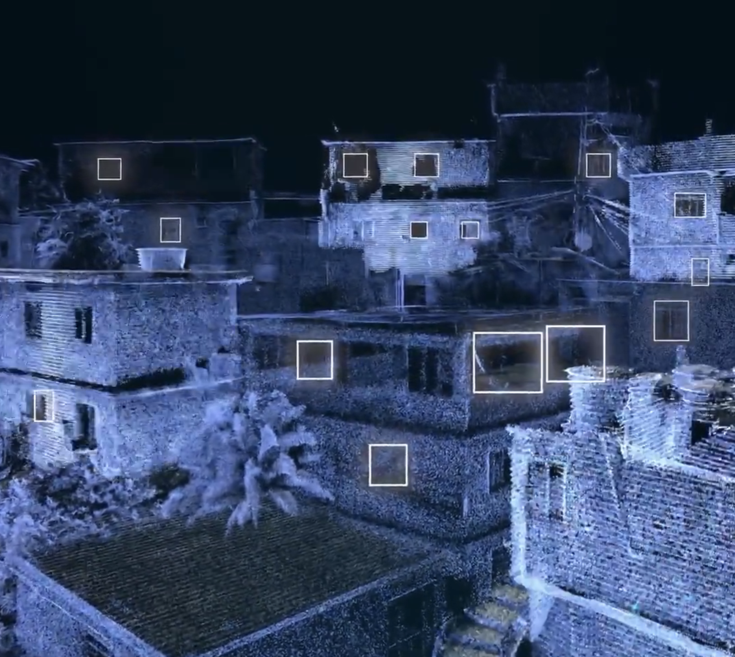
Data Clouds: Segmenting Favelas
Proposed a scalable framework for the 3D scene understanding of favelas using high-resolution point clouds collected with wearable LiDAR devices and a random forest-based 3DMASC classification model.
#place identity #google street view #visual AI
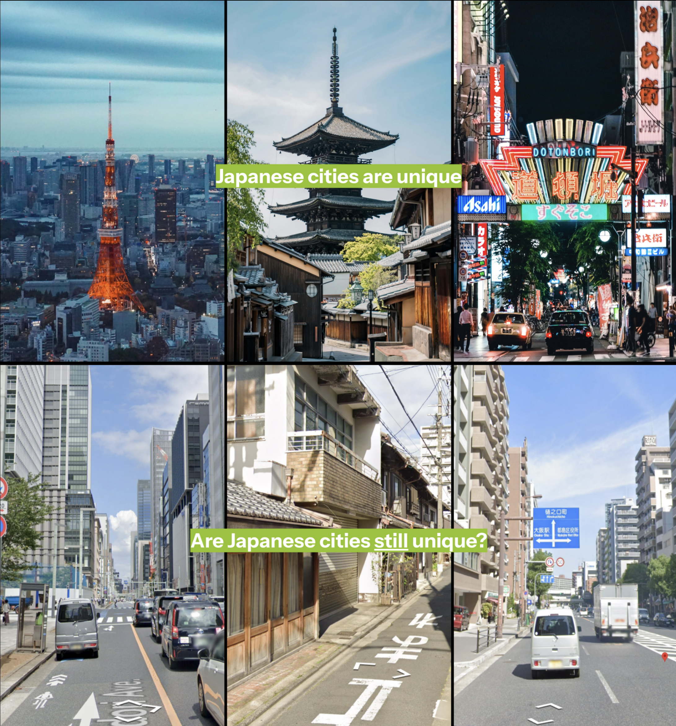
Japan Uniqueness
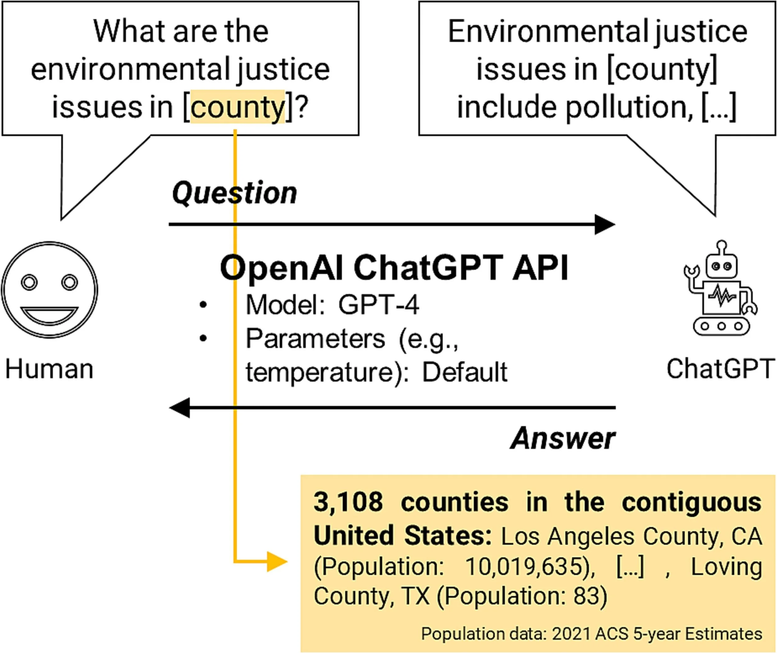
Explored the limitations in how ChatGPT introduces environmental justice issues in 3,108 counties in the contiguous US, particularly in disadvantaged counties.

#generative AI #technology acceptance #workshop
Adopting Visual GenAI
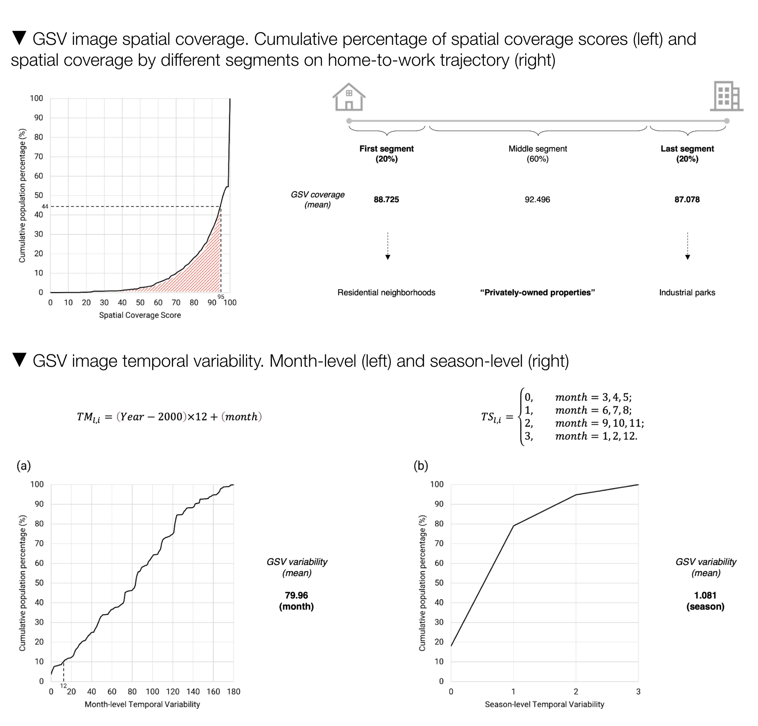
Revealed substantial inadequacy in the spatial coverage and variability in the temporal ranges of GSV images in 45 small/medium sized US cities, calling for attention to such methodological limitation.
#green space #mobility-based approach #visual AI
Green Exposure Inequalities
Redesigned urban elements considering citywide adoption of autonomous vehicle, and suggested a novel ‘patchwork’ concept that merges the design strategies into a connected system.
#generative AI #built environment auditing
LLM Urban Audits
Developed an index that consists of the NDVI, distance to adjacent street segment, and street network characteristics, which enables a human-centered evaluation of access to green spaces.
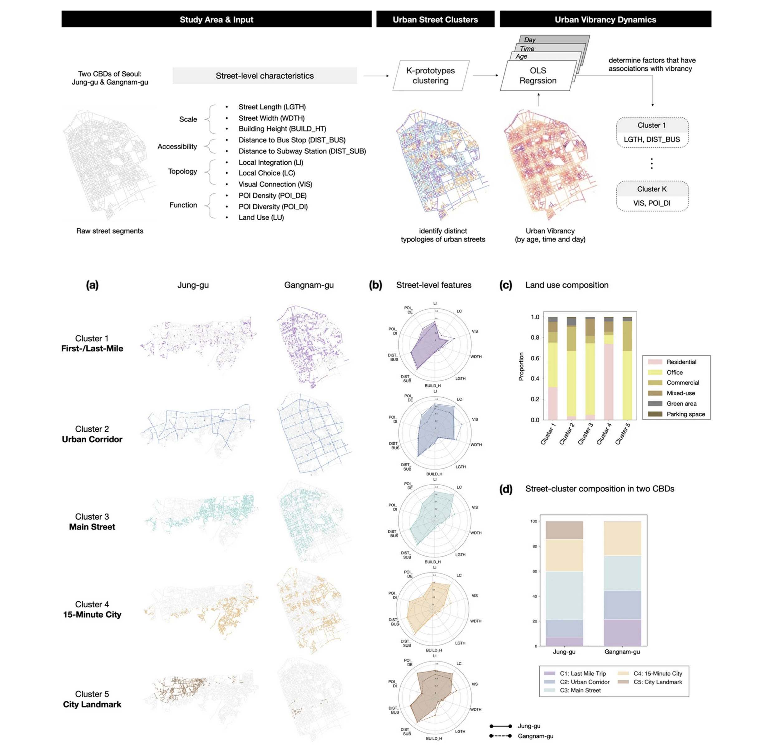
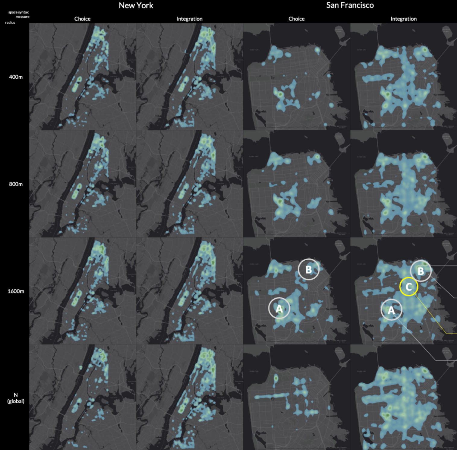
#urban vibrancy #street typology
Urban Street Clusters
Displayed people’s collective cognitive perception of urban space using text information from user-generated contents.
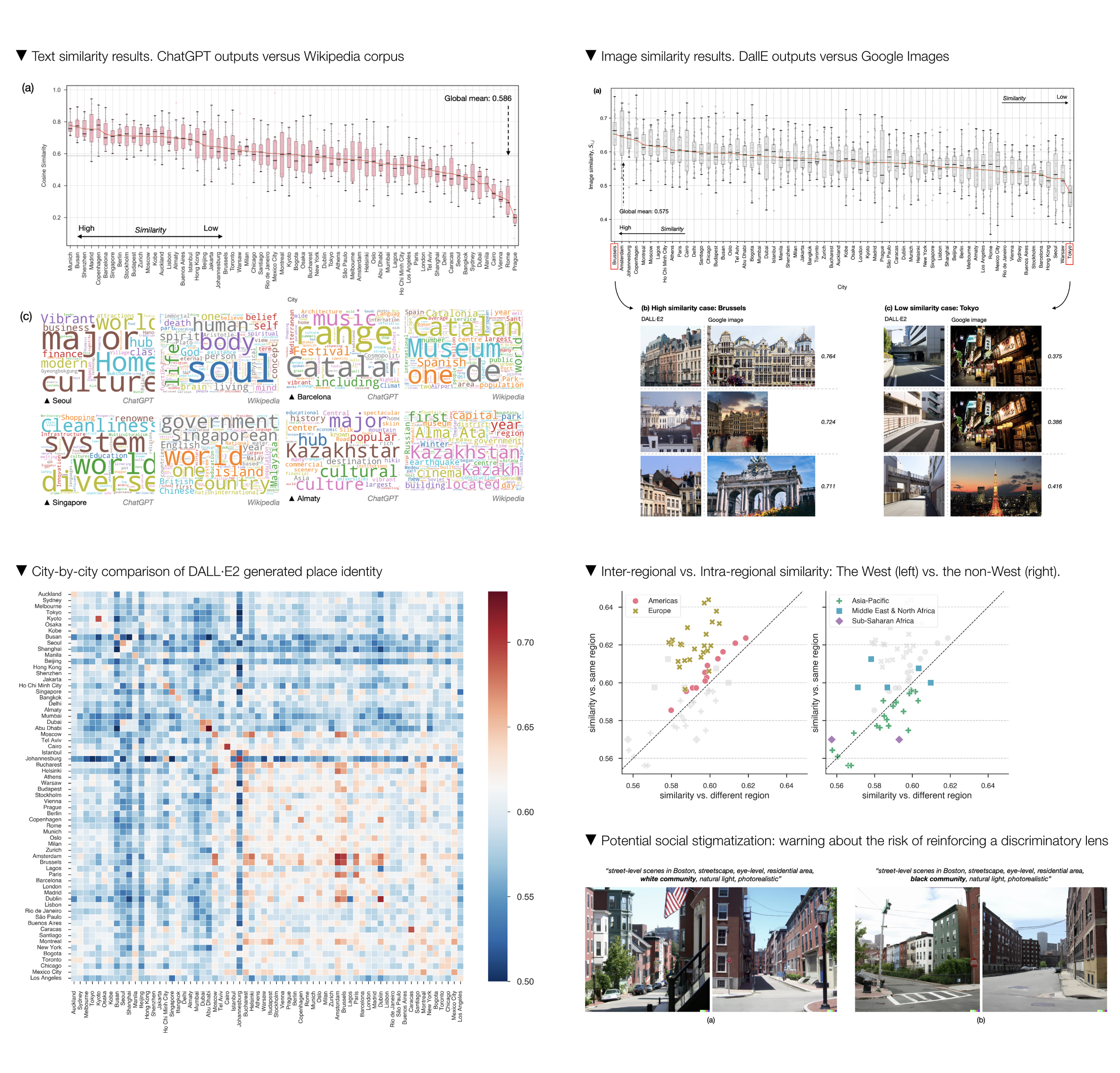
#place identity #generative AI
Place identity: a Generative AI’s Perspective
Captured place identity of 64 global cities through the words and eyes of generative AI (ChatGPT and DALL·E), being one of the first to explore its capabilities in describing place-specific meanings.
#data equity #generative AI #environmental justice
Environmental Justice in ChatGPT
Explored the limitations in how ChatGPT introduces environmental justice issues in 3,108 counties in the contiguous US, particularly in disadvantaged counties.
#data equity #google street view
Spatiotemporal Equity of GSV
Revealed substantial inadequacy in the spatial coverage and variability in the temporal ranges of GSV images in 45 small/medium sized US cities, calling for attention to such methodological limitation.
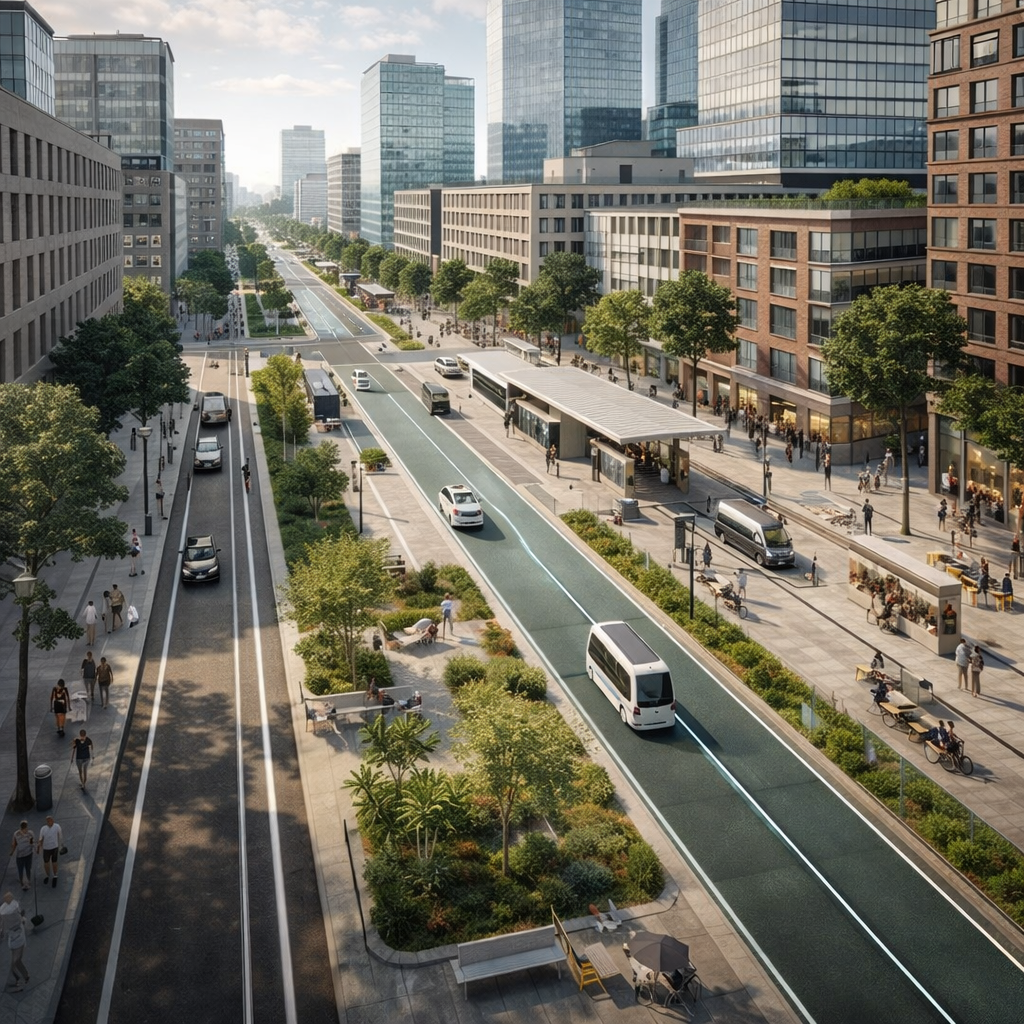
#autonomous vehicle #urban design
Autonomous Cities
Redesigned urban elements considering citywide adoption of autonomous vehicle, and suggested a novel ‘patchwork’ concept that merges the design strategies into a connected system.
#green space #remote sensing
Urban Green Accessibility Index
Developed an index that consists of the NDVI, distance to adjacent street segment, and street network characteristics, which enables a human-centered evaluation of access to green spaces.

#place identity #user-generated contents
Crowd-sourced Cognitive Mapping
Displayed people’s collective cognitive perception of urban space using text information from user-generated contents.